Author 胡以文Updated 2026-05-09 17:14:38Doc ID 1825235 words · 1 min readView original ↗
1 Function description
Real- time display of vehicle location, original latitude and longitude, driving speed and direction in the map, supporting global coverage
Using GPS/Beidou dual- mode positioning technology to receive satellite signals through vehicle- mounted terminals and transmit them to the monitoring platform
Real- time feedback of vehicle running status, including key data such as ignition/flameout, ACC switch status, and oil circuit conditions
Monitor the position of all vehicles in the fleet at the same time, and distinguish the status with different colors/icons (such as online, offline, alarm)
2 operating instructions
2.1 single vehicle monitoring
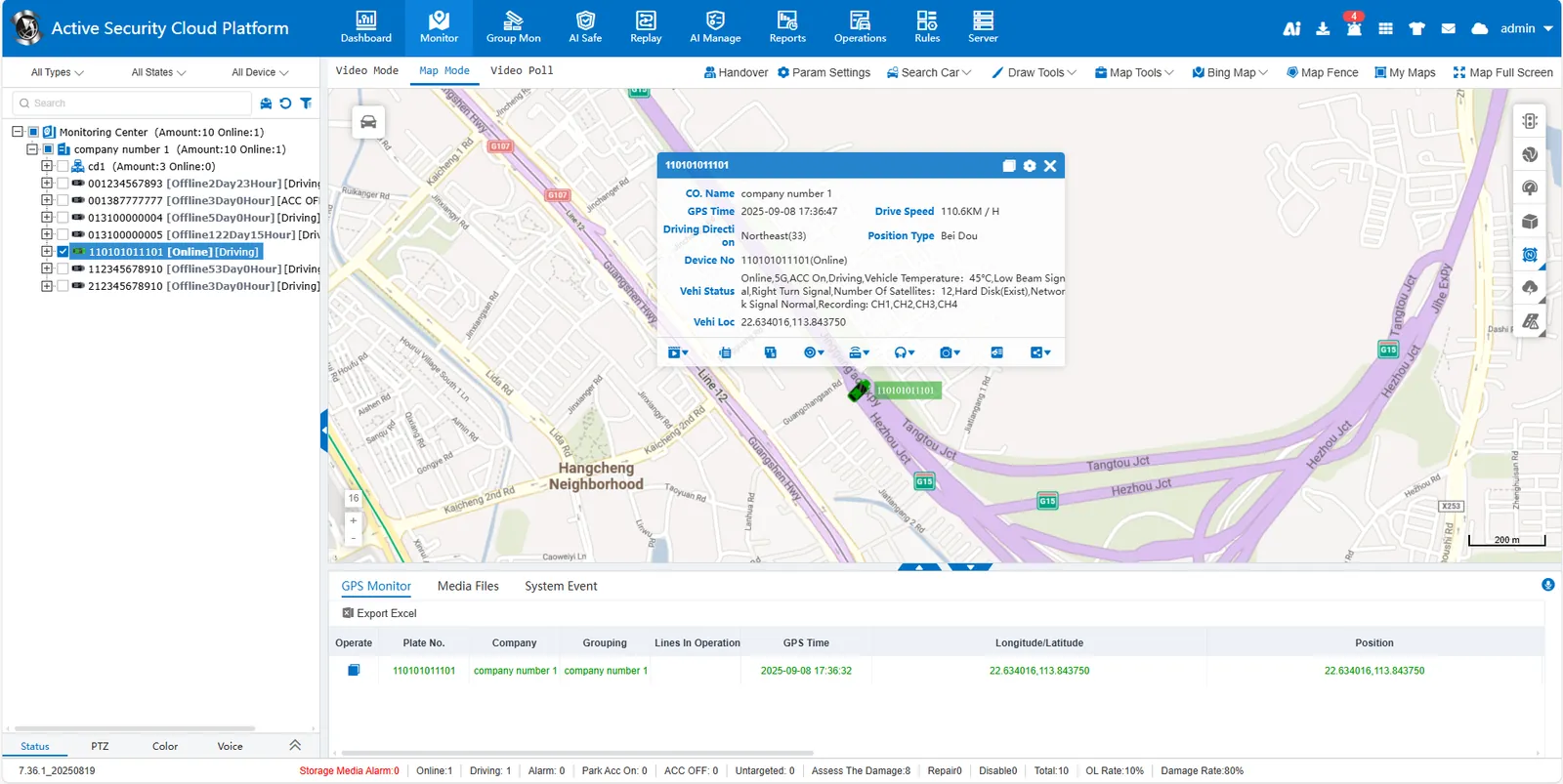
Check the check box in front of the target vehicle in the left monitoring center, and the system will automatically pop up information bubbles (including license plate number, positioning time, vehicle status, vehicle location, etc.) in the map interface.
The full information of the vehicle is displayed synchronously in the Location Monitoring List below.
Click! The button can copy the vehicle information with one click.
2.2 Multiple vehicle monitoring
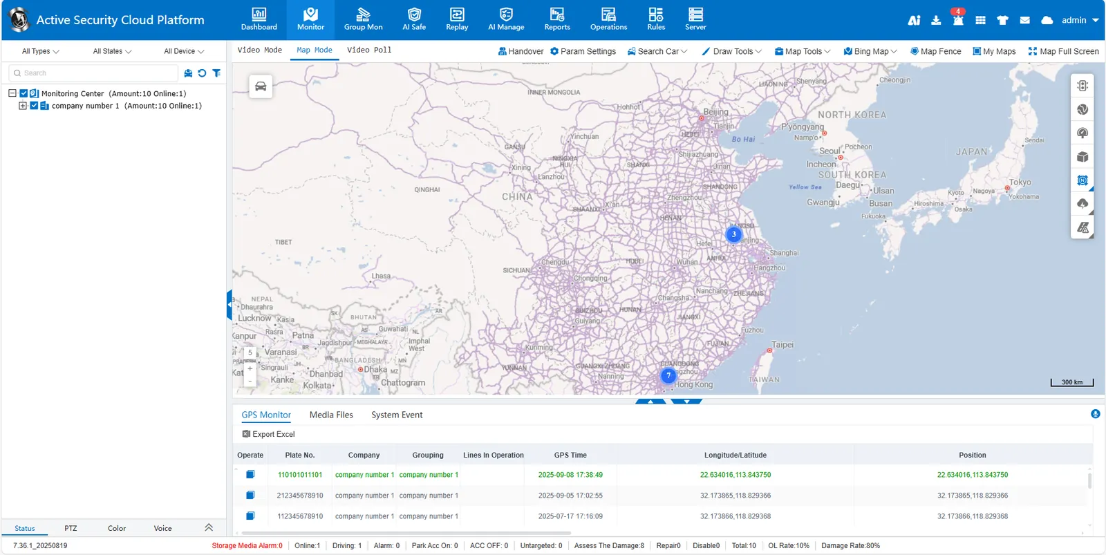
Click Select All to monitor all vehicles, or check the company/fleet to realize group monitoring. The location of vehicles will be displayed on the map, and the default is aggregated.
The Location Monitoring List below synchronously displays all selected vehicle information.
" location monitoring list " Click a single data, and the corresponding information bubble will pop up in the map interface.